Animated Netherlands Map Toolkit for Data Visualization and Travel Paths
By footagOne great value subscription from $16.50/month
- Unlimited downloads of 27+ million creative assets
- AI Tools: video, image and more
- Lifetime commercial license
- Easy cancellation
Already have an account? Sign in
Attributes
- File Size
- 588 MB
- Application Supported
- After Effects
- Required Plugin
- None required
- After Effects Version
- CC
- Commercial License
- Further Information
Description
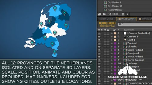
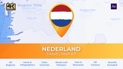
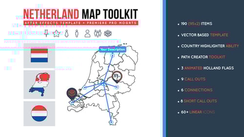
This animated toolkit offers a comprehensive solution for presenting geographical information about the Netherlands. Featuring an interactive map with province highlighting, users can dynamically illustrate regions of interest. The template includes versatile travel path markers, allowing for custom route animations across the map. Additionally, it provides a diverse collection of data callouts and linear icons to enrich visual presentations, making complex information clear and engaging for reports, educational content, or travel-related projects.